UN
47 Sefton Avenue
£ 200,000
Description
We don't have a Description for this property.
- Bedrooms
- 4
- Bathrooms
- 0


Leaflet © OpenStreetMap contributors
The heatmap indicates the level of crime in the area. The color of the heatmap indicates the crime severity and recency.
Metrics Year-on-Year
- Average area value
- 666,863.00 £Decreased by 49.22 %
- Average area rental value
- 2,159.00 £/moDecreased by 16.61 %
- Est rental Yield
- 3.89 %Increased by 64.14 %
- Crime Rate
- 1.00 %Unchanged by 0.00 %
from 1,313,349.00 £
from 2,589.00 £/mo
from 2.37 %
from 1.00 %
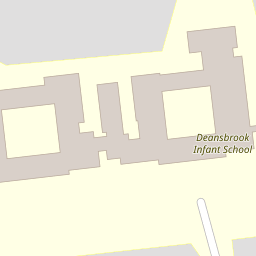
Nearby Schools
| Name | Type | Ofsted | Distance |
|---|---|---|---|
| Deansbrook Junior School | Academy Converter | Good | 0.10 KM |
| Deansbrook Infant School | Community School | Good | 0.10 KM |
| The Annunciation Rc Junior School | Voluntary Aided School | Good | 0.28 KM |
| Mathilda Marks-Kennedy Jewish Primary School | Voluntary Aided School | Outstanding | 0.60 KM |
| Menorah Grammar School | Other Independent School | Inadequate | 0.76 KM |
Images
Nearby Streets
| Name | Average Price | Average Sqft | Distance |
|---|---|---|---|
| Manor Drive | £ 925,000 | 0 | 0.00 KM |
| Langham Road | £ 350,000 | 0 | 0.00 KM |
| Limes Avenue | £ 999,000 | 0 | 0.00 KM |
| Hanshaw Drive | £ 275,000 | 0 | 0.00 KM |
| Compton Close | £ 339,000 | 0 | 0.00 KM |
Nearby Transport
| Name | NLC | TLC | Distance |
|---|---|---|---|
| Mill Hill Broadway | 1527 | MIL | 1.18 KM |
| Hendon | 1522 | HEN | 4.40 KM |
| Elstree And Borehamwood | 1542 | ELS | 4.94 KM |
| Wembley Stadium | 1509 | WCX | 7.16 KM |
| South Kenton | 1453 | SOK | 7.21 KM |
Nearby Listings
| Address | Price | Type | Score | Distance |
|---|---|---|---|---|
| Hale Drive, London, NW7 | £ 425,000 | BUY | Unknown | 0.09 KM |
| Sefton Avenue, London | £ 750,000 | BUY | 5 / 10 | 0.09 KM |
| Sefton Avenue, London | £ 750,000 | BUY | 5 / 10 | 0.09 KM |
| Hale Drive, Mill Hill, London, NW7 | £ 530,000 | BUY | 7 / 10 | 0.11 KM |
| Sefton Avenue, Burnt Oak NW7 | £ 625,000 | BUY | Unknown | 0.15 KM |
Nearby Properties
| Address | Price | Distance |
|---|---|---|
| 41 Sefton Avenue | £ 445,000 | 0.00 KM |
| 47 Sefton Avenue | £ 200,000 | 0.00 KM |
| 37 Sefton Avenue | £ 780,000 | 0.00 KM |
| 35 Sefton Avenue | £ 900,000 | 0.00 KM |
| 33 Sefton Avenue | £ 465,000 | 0.00 KM |